|
|
Post by tbw on May 13, 2012 17:48:14 GMT -5
Hey bc a couple of years ago you posted a picture of yourself standing near the bottom of MTC somewhere in the vicinity below Weir Peak. The photo highlights that I remember was you, of course, and in the background Calhoun hill off in the distance. Could you post that photo here please. Not that we'd all like to see your handsomness, but I observed a geological feature that rather defies the flow of water down that coulee. Didn't say anything at the time, but it has intrigued me for as many years since.
Thanks
tbw
|
|
|
|
Post by joewiggs on May 13, 2012 20:20:32 GMT -5
That would be a wonderful contribution bc and so much appreciated! thanking you in advance, Joe  . |
|
bc
Private

Posts: 18
|
Post by bc on May 14, 2012 1:25:49 GMT -5
Hey bc a couple of years ago you posted a picture of yourself standing near the bottom of MTC somewhere in the vicinity below Weir Peak. The photo highlights that I remember was you, of course, and in the background Calhoun hill off in the distance. Could you post that photo here please. Not that we'd all like to see your handsomness, but I observed a geological feature that rather defies the flow of water down that coulee. Didn't say anything at the time, but it has intrigued me for as many years since. Thanks tbw The photos I have of me at the confluence of MTC and the LBH just show the sweat lodge and realbird campground across the river. Here is one taken from that spot which I call the miniconjou ford looking down river. Bouyer's bluff would be behind me. Just down from the bluffs on the right would be the realbird ford that leads more directly into Deep Coulee. The hill behind it though would be Greasy Grass Hill and the beginning of Greasy Grass Ridge. I have other photos that show how deep the water course portion of MTC is. You could drive a panzer division across Miniconjou ford and be out of sight of troops on Butler and Luce Ridges.  bc |
|
|
|
Post by tbw on May 14, 2012 3:24:27 GMT -5
Thanks bc appreciate this photo very much, could easily be one of my favorites. Sent you a pm.
|
|
bc
Private

Posts: 18
|
Post by bc on May 14, 2012 11:35:39 GMT -5
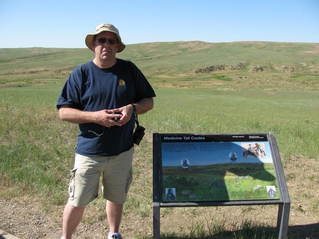
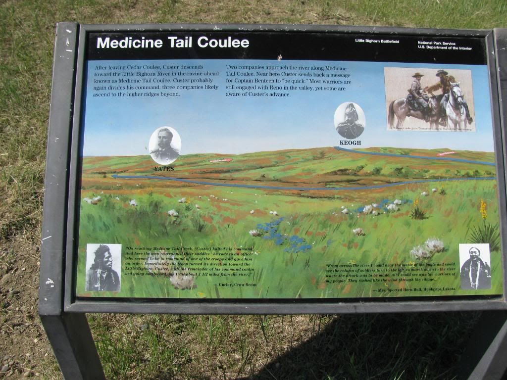
Maybe this is the photo. It isn't of me but of Scott a/k/a Treasuredude. Just going north from Weir Point the road makes a left turn to go east on down to MTF. There is a pull off there with this sign. I believe that is Luce in the direct background and perhaps Calhoun Hill on the left. The MTC water course is over against the north bank of MTC. If it held any water, that would be a good spot to hide your troops while waiting in MTC to charge and get that last drink of water. Now that I look some more, I think that is the LSH monument in the left hand corner of the pic. If that gulley that parallel's Scott's shoulders behind him is North MTC, then that ridge on the right side of the photo above the bluff above the watercourse would be East Ridge. You can see one or more of the Realbird's horses up on that ridge. I'm not sure if I identify Calhoun Hill but that might be the spot where it looks like 2 people are standing. This is a digital pic. bc  Here is what the NPS sign reads. I think according to my other pics that East ridge would be further east from here.  |
|
bc
Private

Posts: 18
|
Post by bc on May 14, 2012 12:00:47 GMT -5
What I like about the first photo of the bluffs along the LBH in MTC is that you can't see those bluffs when going down MTC till you get there other than the absence of a buffalo or travois trail that wouldn't have gone there. But it is consistent with White Bull or whichever NA, that saw troops approach the ford, find the bluffs too steep and have to move over. Suggests to me that they came to that spot and then moved over to the Realbird ford.
bc
|
|
bc
Private

Posts: 18
|
Post by bc on May 14, 2012 14:26:49 GMT -5
|
|
|
|
Post by tbw on May 15, 2012 8:40:51 GMT -5
Woah, hey thanks. Not sure here but the terrain feature I might have been looking for is probably in one of those photos. Most likely is. I was dead sure you were in that photo not TD. Definitely someone younger than ole TD. But I'd bet it was the way the camera angle was to the terrain feature behind the person in question that made it look odd, one of those things only camera's can do, because it looked like one of those weathered drop off embankments was smack dab in the middle of MTC and it was facing away from the way the water should have normally eroded it. (to the east).
|
|
bc
Private

Posts: 18
|
Post by bc on May 15, 2012 9:37:13 GMT -5
|
|
|
|
Post by joewiggs on May 15, 2012 15:37:56 GMT -5
These photographs are terrific! Thank you so Much bc!
|
|
bc
Private

Posts: 18
|
Post by bc on May 16, 2012 7:10:15 GMT -5
Perhaps something to examine is the NPS sign that says the soldiers charged into the cutbank which would be the watercourse area. That is the picture that is also represented that way.
I can't decide if that would be a logical choice to make a charge to. However if that was where the buffalo and travois trails led to, then it would be. It would be the quickest way into the NA vill. But it just seems like a trap if NAs gain the high ground on Bouyer's Bluff.
I wonder what archeological evidence they have to support it according to the sign.
bc
|
|
|
|
Post by tbw on May 16, 2012 8:58:00 GMT -5
Thanks bc for all of those. They're great, super in fact. Don't know about your question. I guess its a question to ask one of the park people to see whether or not they have any idea. Not sure who it was, but when I asked one of them such a question they directed me over to that old building near the cemetery and said the guy over there could answer my questions. Guess my questions t'were too much for them. I didn't have the time then, as we were just getting ready to leave, but rest assured next time I'll go there first, guaranteed.  |
|
|
|
Post by whitebull on May 16, 2012 15:59:33 GMT -5
Thanks Pard for some great photo's. I've never had a chance to get to the battlefield but your pics are the next best thing!  |
|